
Today I'm excited to share the first of two new illustrated map projects - created as part of my Culminating Project for the M.Ed. program I just completed through the Institute for Educational Studies at Endicott College! A main theme of my project was exploring how illustrating a map could foster a sense of place in and stewardship for the natural world, and I collaborated with students at the Community School of Mount Desert Island on this map of MDI:

It was so much fun to work with students by meeting over Zoom and hearing about their research done on the island. Students from each class at the school contributed to the final map with artwork, design ideas like sunrises/moon phases and the seasonal changes of a maple, suggestions for places to plot on the island, and wildlife they had seen there. Here is a section of our map to show a bit more detail:
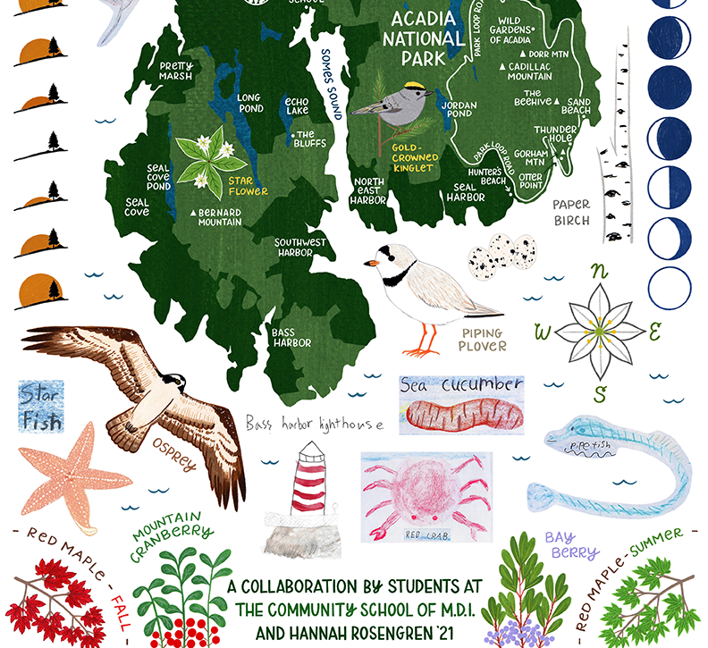
Many thanks to the Community School for working with me on this project! Check out more of their work at thecommunityschool.me.