
I’m also excited to share this second component of my Culminating Project (check out the first one here) recently completed for grad school - an illustrated map of the Rachel Carson National Wildlife Refuge here in southern Maine:
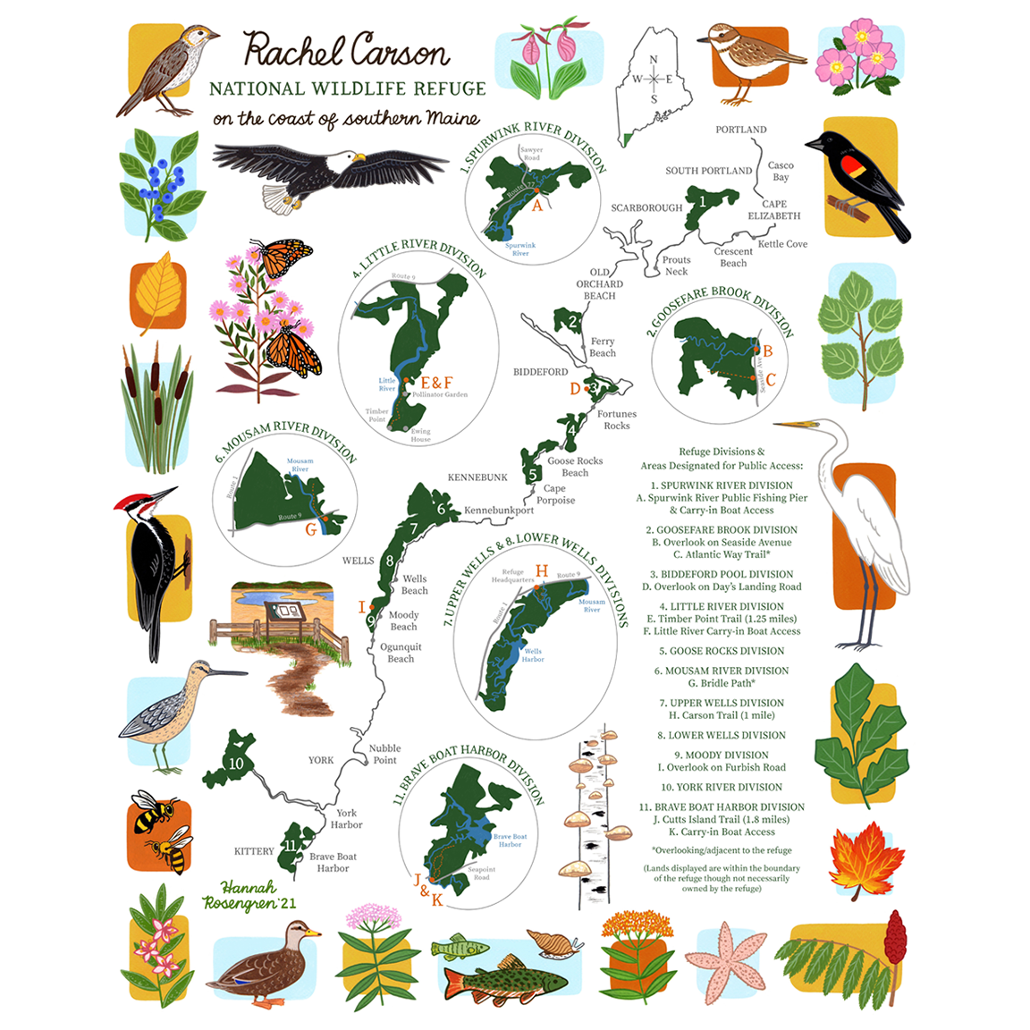
Last fall, I read two of Carson’s books - Silent Spring and The Sense of Wonder - and knew there was a refuge named after her in Maine but had no idea how expansive it was. Since my Culminating Project focused on utilizing illustration to foster a sense of place and stewardship, the refuge was the perfect place for me to explore and illustrate. Here’s a detail of the top-left corner to show a bit more detail:

I began the map by making a list of public access points along the refuge (since most refuge lands are closed to the public to protect sensitive habitats and wildlife). Then I visited each spot, especially taking note of the educational signs posted throughout the refuge detailing wildlife found there. Below are some of my favorite trails with zoomed-in details of their accompanying map from the full illustration:
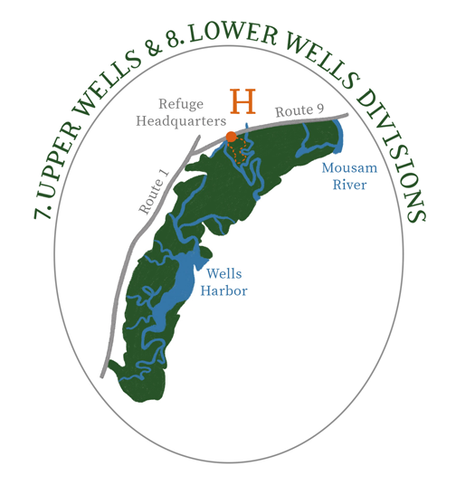
CARSON TRAIL
Upper Wells Division, Wells
This trail starts at the refuge headquarters at 321 Port Road in Wells. It follows a 1-mile loop through the woods with some beautiful spots overlooking the Merriland River and Little River.


TIMBER POINT TRAIL
Little River Division, Biddeford
This trail in Biddeford has definitely become one of my favorite places to visit in the refuge. The trail starts at the end of Granite Point Road along a beach, winds through the woods, and ends with a stunning view of the coast from Timber Point. I even came across a pollinator garden when walking the trail last fall and am especially looking forward to revisiting it this spring.


CUTTS ISLAND TRAIL
Brave Boat Harbor Division, Kittery
Another amazing trail on the refuge is the Cutts Island Trail in Kittery. This one is 1.8 miles long and loops through the woods, ending with an overlook of Chauncey Creek (a scene I illustrated towards the bottom-left corner of my map).

If you’re a local reading this, I hope you’ll check out some of these spots for yourself! You can also find prints of the illustrated map here in my shop; 20% of each sale will be donated to The Friends of Rachel Carson National Wildlife Refuge (learn more about their work here).